
Zealandia: Mapping Earth's Hidden Eighth Continent
द्वारा संपादित: Svetlana Velgush
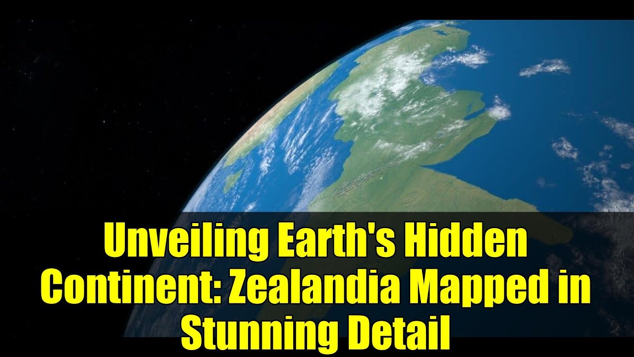
Zealandia, also known as Te Riu-a-Māui, is a submerged mass of continental crust located in the southwest Pacific Ocean. Spanning approximately 4.9 million square kilometers, it is predominantly submerged, with only about 5% of its landmass, including New Zealand and New Caledonia, visible above sea level. This extensive submerged landmass has been the subject of scientific research to understand its geological history and significance.
Recent studies have provided insights into Zealandia's geological features. Analysis of rock samples from the seabed has revealed a significant volcanic region that developed during Zealandia's separation from the supercontinent Gondwana between 100 and 60 million years ago. This volcanic activity played a crucial role in the continent's formation and subsequent submergence. Additionally, the discovery of a 4,000-kilometer-long granite belt, known as the Median Batholith, has been identified as Zealandia's geological backbone, connecting its submerged and exposed parts. These findings enhance our understanding of Zealandia's dynamic geological history and its role in Earth's tectonic processes.
Understanding Zealandia's geological history offers valuable insights into the processes of continental break-up and submergence. The continent's formation and evolution have implications for studying Earth's tectonic movements and the distribution of natural resources. Ongoing research continues to explore Zealandia's geological features, contributing to a deeper comprehension of Earth's geological history and the forces that have shaped its continents.
44 दृश्य
स्रोतों
cianjur.viva.co.id
Kompas.com
BBC News Indonesia
Liputan6.com
इस विषय पर और अधिक समाचार पढ़ें:


क्या आपने कोई गलती या अशुद्धि पाई?हम जल्द ही आपकी टिप्पणियों पर विचार करेंगे।